http://www.autodesk.com/products/autodesk-autocad/overview
Free trial here: http://www.autodesk.com/products/autodesk-autocad/free-trial
Free trial here: http://www.autodesk.com/products/autodesk-autocad/free-trial
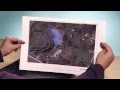
Access online maps directly inside the canvas. Now you can also capture them as static images and print them. The maps that were integral to your design can now be part of your final drawing. Now you can plot to paper or create PDFs that include the geolocation map.
Source: Autodesk


